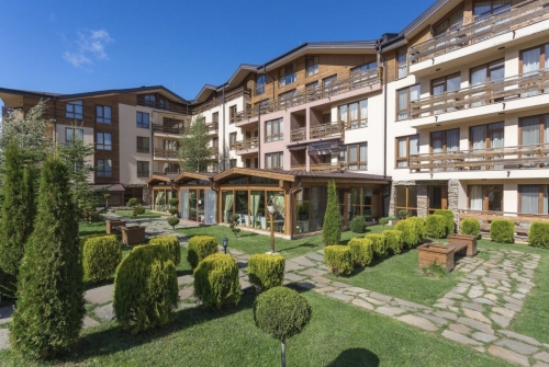
Lozenets
Lozenets is located just south of the city center and has a predominantly residential character, bordering South Park to the west and Borisova Gradina to the east. The district has a distinct topography with two distinct sections—Lower Lozenets and Upper Lozenets. The northern part lies lower, at the level of the Perlovska River, while the southern part is 60–70 meters higher, with a slope featuring terraced developed plots and steep streets. Until the early 20th century, the present-day Lozenets was a suburban area south of Sofia’s borders, occupied by vineyards and gardens. At the district’s center, above St. Naum Boulevard, lies the Lozenets governmental residence. A significant portion of the area is filled with low-rise residential buildings amid tree and shrub vegetation, where one- and two-story homes with yard spaces alternate with three- to five-story cooperatives. Lozenets is considered a residence for affluent individuals, which determines the high property prices here. It is served by three tram lines and four bus lines, with a metro station in its northwest corner.
Lyulin
Lyulin is an iconic Sofia district, 90% of which consists of panel blocks, and by population, it could be considered Sofia’s largest district, equivalent to Bulgaria’s fifth-largest city. EPK blocks are also present in nearly all parts of the district. The residential complex is divided into 10 microdistricts, and getting lost here is almost certain without a map or by not following the block numbering, where the first digit indicates the corresponding microdistrict. Like any other city, if you need to buy something, you can stop almost anywhere. Some Lyulin residents proudly say they haven’t left the district for years. Often, there’s no need—after all, Lyulin’s ten microdistricts have countless taverns, several pizzerias, a disco, every type of hypermarket, and dozens of auto repair shops. Lyulin is located in Sofia’s northwest. To the west lies the Ring Road and Filipovtsi district, to the north Obelya, to the northeast, beyond Europe Boulevard, is Moderno Predgradie, and to the southeast Zapaden Park, one of the city’s major parks. New construction is concentrated mainly in microdistricts served by the Sofia Metro and around the complex’s center. Old brick blocks built before 1990 are extremely rare. Lyulin features all types of public transport operating in Sofia: three metro stations on the first diameter, one tram line, two trolleybus lines, and 12 bus lines. The education system is organized territorially by microdistricts, including 11 combined childcare facilities, four full-day kindergartens, and 12 schools. It houses one of Sofia’s largest cooperative markets, considered the unofficial center of the residential district, along with numerous fast-food outlets, cafés, a disco, and a supermarket.
Malashevtsi
Malashevtsi is a district in Sofia’s northeast, annexed to the city in 1961. It borders Hadji Dimitar to the southeast and Orlandovtsi to the north. The district is predominantly built with single-family homes and a few panel blocks. It houses one of Sofia’s largest cemeteries—the Malashevtsi Cemetery Park—and a major antiques and second-hand goods market known as Bitak.
Malinova Dolina
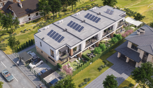
Malinova Dolina is located in Sofia’s southern part, away from urban noise, near the American College. It lies west of Mladost-4 and borders the Ring Road to the south. St. Clement of Ohrid Boulevard passes through the district, with numerous warehouses, small production facilities, and office buildings on both sides near Derventitsa. The Sofia Business Park and surrounding offices are a 10-minute drive away. Malinova Dolina is one of Sofia’s expensive districts, primarily built with single-family homes, as it was originally intended as a villa zone. However, it lacks schools, healthcare facilities, or kindergartens. Convenient access to Sofia’s center is only possible via Dragan Tsankov Boulevard. It’s expected that Malinova Dolina will experience a minor construction boom, with several large projects announced and over 100 plots available for residential development.
Manastirski Livadi
Manastirski Livadi is a district in Sofia’s southern part, located near Vitosha. It lies on both sides of Bulgaria Boulevard, before the Ring Road. To the west, it borders Bukston Brothers Boulevard, to the north Todor Kableshkov Street, to the east Krastova Vada, and to the south the Ring Road. The western part is densely built and continues to develop with new residential buildings. The district is one of Sofia’s fastest-growing areas. Manastirski Livadi’s proximity to Sofia’s center and service by one of the capital’s fastest transport arteries—Bulgaria Boulevard—make it attractive. Its location near Vitosha and prestigious residential districts like Boyana, Dragalevtsi, and Kino Center on one hand, and its 15-minute drive to Sofia’s center on the other, make it a preferred place to live. Despite its relatively good location, Manastirski Livadi has a reputation as a poorly planned and executed district. The main issue is overdevelopment and insufficient infrastructure, lack of recreational areas, parks, schools, kindergartens, unlit streets, missing sidewalks, etc. Roads and infrastructure overall fall short of Sofia’s average standards. Many buildings remain vacant for two to three years. Even if you find a project with modern architecture, quality execution, and well-designed spaces, you’ll face dug-up, poor-quality roads resembling dirt tracks in some areas for the next five years. The district lacks a detailed urban plan, allowing dozens of investors to bypass laws and build as they please. Its relentless expansion, with new cooperatives, has led to over 5,000 residents living there, but only two streets for car entry/exit and two and a half pedestrian routes to public transport stops, with recreation areas and the only playgrounds located in the neighboring Gotse Delchev district. It’s one of Sofia’s southern districts, near Vitosha, with a reputation as an expensive area. The name might suggest meadows and monasteries in this part of the capital, but instead of flowers and trees, blocks sprout like mushrooms. Since its creation, Manastirski Livadi immediately attracted nouveau riche with modest incomes who, during the credit boom before the financial crisis, massively invested in apartments in the area. Many later faced difficulties, as the district had apartments but no streets in the following years.
Mladost
Mladost is located in Sofia’s southeast, covering about 1,700 hectares and accounting for around 10% of the city’s area. It is among Sofia’s most modern and rapidly developing districts. It houses Eastern Europe’s largest business complex—the Sofia Business Park. To the west, it borders Derventitsa and Musagenitsa; to the south, the Kambanite area and the Ring Road; its southeast edge is about 2–3 km from Gorublyane, and to the north, it borders Tsarigradsko Shose Boulevard, Druzhba, and Poligona. Until the early 1990s, residential buildings were constructed as panel and EPK structures. Since the 1990s, new buildings have been built using monolithic construction, with their numbers steadily increasing. Mladost is divided into five microdistricts: Mladost-1, Mladost-1A, Mladost-2, Mladost-3, and Mladost-4. Transport services are provided by the Sofia Metro, as well as buses and trolleybuses. The district has two markets, numerous shops, major retail chains, gas stations, schools, kindergartens, hospitals, and regional medical centers (DKTs).
Moderno Predgradie
To the south, the district borders Lyulin’s 8th, 9th, and 10th microdistricts, with Sliwnitsa Boulevard—the city’s major transport artery—serving as the boundary, ensuring quick access to the center. It extends to Pancho Vladigerov Boulevard to the west, borders the Bakarena Fabrika Cemetery Park, Vrabnitsa 1, Nadezhda 3, and Nadezhda 1 to the north, and Zaharna Fabrika to the east. Development began in 1914, with residents primarily living in houses. There are also panel blocks built in the early and mid-1990s. The district faces sewerage issues. At the intersection of Sliwnitsa Boulevard and Pancho Vladigerov Street/Obelsho Shose, the Sliwnitsa metro station allows residents quick access to Sofia’s center.
Musagenitsa
Musagenitsa is in Sofia’s southeast, bordering Derventitsa to the southeast, Derventska River and Tsarigradsko Shose Boulevard to the northeast, Dr. G. M. Dimitrov Boulevard to the northwest, and St. Clement of Ohrid and Prof. Marko Semov Boulevards to the southwest. Neighboring districts include Mladost 1, Derventitsa, Student City, and Iztek. Musagenitsa is an exceptionally quiet district with large green inter-block spaces, making it one of the preferred areas. It is primarily built with panel blocks constructed between 1970 and 1985, so it has more greenery compared to other panel complexes in the capital. Eight-story panel blocks with external balconies and taller EPK buildings predominate. In recent years, several brick cooperatives have been built in the southern part near the Regional Hospital. Transport services include all types of public transport—metro, trams, trolleybuses, and buses.
Nadezhda
One of Sofia’s oldest districts, its history began in 1906 as a mere suburb, then a village, becoming a district in 1936. The name was given by the first settlers in honor of Tsar Boris III’s youngest sister, Princess Nadezhda. It’s one of Sofia’s largest districts, located in the northwest. To the east, it borders Tolstoy; to the north, Svoboda, Iliyantsi, and Northern Park; and to the west, Obelya. Nadezhda is far from the center but now excellently connected via the metro. The complex spans 19,300 decares, with over 80,000 residents and four microdistricts. The area has become highly accessible without losing its advantages—green spaces, quiet streets, especially in inner areas with many trees. Nearby are Northern Park and Lokomotiv Stadium. The district has good infrastructure, with predominantly panel construction, some EPK, and limited new brick construction. Transport services, besides the metro, include several bus lines and one tram line for one microdistrict.
Obelya
Obelya lies on one side of Northern Park—a district similar to Nadezhda but smaller and with more houses than blocks. Declared a Sofia district in 1961, it gradually acquired its current appearance. Covering 94 hectares, it has around 20,000 residents and is 8 km northwest of Sofia’s center by air. It borders Moderno Predgradie to the south and Vrabnitsa to the east, extending to the city’s northern railway line to the north. There are no industrial enterprises, so there are no significant environmental issues. Major transport routes with heavy traffic don’t pass nearby. One advantage of residential buildings is the peace, far from urban noise. It’s predominantly built with large single-family homes, 3–9-story panel blocks, and taller EPK blocks up to 16 stories. Buildings remain unamortized compared to other similar complexes built 40–50 years ago, but there are few green spaces between blocks. The district is served by the metro, one tram line, and several bus lines.
Oborishte
Oborishte encompasses part of Sofia’s center, between Sliwnitsa, D. Nikolaev, Sitnyakovo Boulevards, Han Omurtag, Shipka, Paris, and Moscow Streets, spanning 3,070 decares. After Liberation, the rapidly growing city transformed Oborishte into one of the capital’s most prestigious areas. In dignified homes built by the country’s industrial, commercial, political, and cultural elite, policies and economics shaping Bulgaria’s life were forged. This legacy was continued by the communist elite, making Oborishte a preferred residence for the influential of the day, regardless of the historical era. The district is characterized by aristocratic buildings built before World War II and monolithic cooperatives from the 1970s. In recent years, several new luxury office and residential buildings have been constructed. Its center features the Doctor’s Garden. The district is quiet and peaceful, except for Shipka Street, which has a public transport route. It boasts 477 decares of parks and gardens, educational and childcare facilities, hospitals, polyclinics, embassies, theaters, religious, and administrative buildings. It is Sofia’s most expensive residential district in terms of real estate.
Ovcha Kupel
The district’s name is linked to thermal water that gushed after an earthquake in 1858, when sheep grazed on marshy meadows, literally meaning “sheep bath.” Later, the water was captured, and a bathhouse was built, operating until the early 1980s. A rehabilitation hospital was also constructed nearby. The district once had resort status. The balneocomplex is near the Vlaydaska River on the district’s western side, while the Slavia Sports Complex is on the east. Ovcha Kupel expands westward, with the socialist-era residential complex taking the same name for its two parts—Ovcha Kupel 1 and 2—built with panel residential buildings and blocks using large-panel framing. Located about 6 km from the city center, it will develop as an interesting district due to four stations on the third metro line, expected to be completed by fall 2019. It borders Slavia to the east and Gorna Banya to the west. Its proximity to major boulevards and quick connections to Sofia’s center also make it attractive. Four bus lines and two tram lines serve transport, with links to the Ring Road.
Orlandovtsi
The district is in the northeast part of the city, between Malashevtsi to the southeast and Iliyantsi to the northwest. Until 1961, when it was annexed to the city, Orlandovtsi was an independent village. It houses Sofia’s Central Cemeteries. To the southwest, it borders First Bulgarian Army Boulevard, separating it from the broader city center, Central Railway Station, and Bus Station. To the southeast, it borders Malashevtsi and Hadji Dimitar, and to the north, Konstantin Preslavski Street divides it from Benkovski. It’s one of Sofia’s oldest districts, predominantly built with single-family homes and just a few panel blocks. It also has a Roma population often living in illegal structures. Extremely green, quiet, and calm, it offers great potential for new brick cooperatives and office buildings. Three tram lines and ten bus lines serve transport in the district.
Pavlovo
Though more remote to the south from the city center, this district can provide peace, quiet, and a feeling of being outside Sofia. It’s close to the mountains, very green—offering numerous opportunities for walks, quiet, and not overcrowded. It borders Tsar Boris III Boulevard to the northwest, Nikola Petkov Boulevard (Ring Road) to the south, and Bukston Brothers Boulevard to the east. The district is characterized by low-rise construction—houses and small cooperatives. In recent years, it has been actively developed, like other parts of Sofia. Despite its distance from Sofia’s center, Pavlovo has a well-developed infrastructure. Streets are paved and maintained. Transport links include three tram lines and five bus lines.
Poduyane
Poduyane (or Poduene) is one of Sofia’s earliest districts. Located north of Reduta, south of Suhata Reka residential complex, northwest of Hristo Botev, and west of Vasil Levski, it’s near Oborishte Park and Madrid, Botevgradsko Shose, and Sitnyakovo Boulevards. Poduyane, officially annexed on January 1, 1891, by Prince Ferdinand I’s decree of March 16 that year, is one of Sofia’s first districts, surrounded by railway lines on nearly all sides. Due to its proximity to the center and convenient connections via Vladimir Vazov and Botevgradsko Shose Boulevards, it has become a preferred location for residential investment. New constructions cover the district’s main boulevards and the Pirdop Square intersection, featuring 6–8-story residential buildings with commercial spaces on the ground floor. The buildings harmonize with the surrounding development, creating small internal neighborhoods.
Rassadnika-Konyovitsa
Rassadnika-Konyovitsa is a district in western Sofia, a 10-minute ride on public transport from the city center. It’s well-organized with ample green spaces and good connectivity. To the north, it borders Alexandar Stamboliyski Boulevard and Ilinden; to the east, Konstantin Velichkov Boulevard (Zone B-19); to the south, Serdika and Vlaydaska River; and to the west, Vardar Boulevard (Krasna Polyana 1). Panel construction predominates, with several building categories—old panel blocks, brick buildings, newer panel buildings, EPK blocks, and modern brick cooperatives built over the last decade. Rassadnika is one of Sofia’s greenest districts. In its southeast, there’s Sts. Peter and Paul Park and a church of the same name.
Reduta
Reduta is one of those districts that are close to the center yet far enough for peace and quiet. In 1856, immediately after the Crimean War, a fort with a battery was built here to defend Sofia. In the early 20th century, the area was a vast hill with many meadows, but settlement and block construction soon began, gradually shaping its current appearance. It borders Poduene to the north, Geo Milev to the south, and Slatina to the east. An interesting fact: a massive bunker lies beneath the district, last used during World War II bombings.
Sveta Troitsa
Sveta Troitsa is located in Sofia’s western central part. To the south, it borders Ilinden; to the east, Baniшora and Zone B-18; to the northeast, Fondovi Zhilishta; to the northwest, Zaharna Fabrika; and to the west, Gevgelijski. Major transport arteries are Sliwnitsa, Konstantin Velichkov Boulevards, and Gabrovo Street. Founded in the 1920s by Bulgarian refugees from Macedonia, mainly from Doiran, the district’s southeast features Sts. Peter and Paul Park and a church of the same name. Sveta Troitsa is well-organized, with abundant greenery in inter-block spaces, featuring panel blocks from the late 1960s to the late 1980s, EPK blocks grouped in 3–4 and scattered across various ends along Sliwnitsa Boulevard and smaller streets. Old brick blocks from the 1960s are near the park and Konstantin Velichkov Boulevard. New brick cooperative construction is now developing in line with transport infrastructure.
Simeonovo
Originating centuries ago, Simeonovo has evolved into Sofia’s expensive villa zone. It’s near the Simeonovo-Aleko cable car. The Ring Road to its north provides convenient connections to the center and other city districts. Until 1961, when it was annexed to the city, Simeonovo was a separate village. Over time, it became Sofia’s premium villa area. Its connectivity to the city center and Vitosha Mountain, along with excellent views, make it extremely attractive for living, preferred by the business elite and people of high social status. The district is predominantly built with luxurious single-family homes and villas with spacious yards, as well as charming family hotels. Several gated complexes are under construction or operational. However, parts of the district lack a sewer system, relying on septic tanks. Transport links include only two bus lines, but the metro extension to the Business Park will significantly reduce travel time to the center.
Slavia
Slavia District is located in Sofia’s southwest. To the northeast, it borders Lagerat, and to the south, Krasno Selo. To the east, it adjoins Tsar Boris III Boulevard; to the southwest, a park reaches Ovcha Kupel Boulevard and Slavia Stadium; and to the northeast, Zhitnitsa Street. It’s one of Sofia’s old districts, characterized by low-rise brick construction from the 1960s and monolithic construction from the 1980s. Inter-block spaces are well-maintained with plenty of greenery. The main transport artery, Tsar Boris III Boulevard, hosts numerous residential blocks. To the north, the Zemlyane urban transport garage, Han Asparuh Equestrian Base, and the enclosed Slavia Sports Complex are located.
Slatina
Slatina is a Sofia district between Geo Milev, Reduta, and Hristo Botev. The distance to Sofia’s center is relatively short. Nearby are Poduyane Station and Sofia Airport. It features many parks and gardens for walks and relaxation, plus numerous entertainment spots. Until 1961, Slatina was a village east of Sofia, merged with the city by decree on November 9 of that year. The district hosts Festivalna Hall, Akademik Stadium, and nearby Georgi Asparuhov Stadium. Residential buildings are 65% brick or EPK. The district is relatively peaceful, not yet overdeveloped, with large inter-block spaces and parking areas. It’s a good place to live in Sofia.
Strelbishte
Strelbishte is a Sofia district in the city’s southern part, in the so-called broader center. It borders Petko Y. Todorov Boulevard and South Park, along with Ivan Vazov Market, to the east; Gotse Delchev Boulevard to the south; and Bulgaria Boulevard to the northwest. Named for the shooting ranges of the First and Sixth Infantry Regiments, it features a mix of panel, brick, EPK, and modern construction. Strelbishte is one of Sofia’s most connected districts, linked by trams, trolleybuses, and buses.
Student City
Student City is in Sofia’s southeast, bordering Dianaabad, Derventitsa, Vitosha, and Malinova Dolina. Located in the foothills of Vitosha, it was designed from the outset as a student town, with dozens of high-rise dormitories to meet the housing needs of Sofia’s university students. Today, besides housing thousands of students, it’s an area with six prestigious higher education institutions, four of national status. In recent years, Student City has experienced a true construction boom, with new residential, commercial, sports, and business centers emerging. Beyond the typical Sofia district challenges of parking shortages, Student City, with its numerous establishments, resembles an amusement park. The overall atmosphere feels like a resort town, though bookstores are absent, but the abundance of bars, pubs, and discos supports this theory. Nevertheless, it’s becoming an increasingly preferred place for young families, especially in its southern part—around the Winter Palace, National Sports Academy, and family dormitories. The area offers excellent conditions for sports, relaxation, walks, entertainment, and more. The multifunctional Hristo Botev and Winter Sports Palace halls host numerous events annually. The district is in one of Sofia’s areas with a relatively high percentage of preserved green spaces and clean air, with no industrial development planned. Its relatively good infrastructure and easy access to other parts of Sofia are among its advantages, but intense residential construction doesn’t support maintaining its status or enhancing its prestige as a university center.
Suhata Reka
Suhata Reka is located northeast of Sofia’s center, bordering Hadji Dimitar and Stefan Karadzha to the west and northwest, Botevgradsko Shose Boulevard to the east, and Levski V district to the north, with Reduta to the south. Main connections to the center are via tram, bus, and trolleybus lines. Blocks are mostly panel and EPK. The district has several kindergartens and schools, a market, a park, and expansive inter-block spaces; it includes Georgi Asparuhov Stadium, with the center reachable in minutes, even during traffic jams.
Fakulteta
Fakulteta (locally Fakulteto in the Shop dialect) is a district in western Sofia, north of Barite, south of Western Park, west of Krasna Polyana, and east of Suhodol. Known as Sofia’s Roma ghetto, with a population of 50,000, it has nearly 20% unemployment. The reasons for such high unemployment among Roma include lack of education and the closure of many industrial enterprises in Sofia. The district is socially isolated from the city, forming closed communities that impact the urban environment. It lacks basic public space elements—squares, gardens, and playgrounds. Fakulteta is named after the Agricultural Academy, founded in 1961, also known as the Agrarian Faculty. It offers quick access to the center.
Hadji Dimitar
Hadji Dimitar is among Sofia’s oldest districts. During socialism, after demolishing some small houses, it transformed into a residential complex. Its architecture is an incredible blend of new and old—low cottages and 16-story blocks, wide paved streets, and green meadows, with a monument to Hadji Dimitar at the district’s heart. The old includes single-family homes, low brick, 6–, 7–, 8-story blocks. To the north is Malashevtsi, to the east Stefan Karadzha, to the south Poduyane, and to the west Orlandovtsi. A well-developed district in Sofia’s northeast, its unique proximity to the center allows easy, quick access to various city points via trolleybuses. Located minutes from Prince Alexander Dondukov Boulevard, the third Sofia Metro line is under construction, passing through the district.
Hipodruma
Hipodruma is a well-maintained district near Sofia’s center—quiet and lush, making it a preferred place to live. To the southeast, it borders Bulgaria Boulevard; to the southwest, Kjustendil Street; on its western edge, Tsar Boris III Boulevard; and along its northeast, Academician Ivan Geshov Boulevard. The district is characterized by low-rise brick construction from the 1960s, monolithic construction from the 1980s, and EPK construction. New construction began in the late 1990s, mainly around Ruchey Square and Bulgaria Boulevard, and in a small block near Tsar Boris III Boulevard. Hipodruma has excellent infrastructure, including all transport types for fast, easy connections to the center. A connection to the third metro line is forthcoming.
Hladilnika
Hladilnika is a small Sofia district, bordering Lozenets to the north, South Park to the west, Vitosha and Krastova Vada to the south, and Hunting Park and Sofia Zoo to the east. Historically, a ring railway passed through the district, with large refrigeration warehouses branching off, giving it its name. Most of Hladilnika’s area is occupied by industrial, commercial, and administrative facilities. Since the mid-1990s, high-density multi-story residential buildings have been constructed. Located near the new U.S. Embassy and Lozenets University Hospital, property and office prices here match those in Lozenets. Like most Sofia districts with intense development, Hladilnika’s road infrastructure is severely inadequate for its growing population, with heavy traffic jams to the city center and Ring Road being daily occurrences. The metro provides good connectivity to the rest of Sofia.
Hristo Botev
Hristo Botev is a district near Botevgradsko Shose and Sofia Airport. Its population is mixed—Bulgarians and Roma. It hosted the first successful project building 11 blocks of housing for socially vulnerable groups. Infrastructure includes shops, cafés, an internet café, a pool, a secondary school for automotive transport, a kindergarten, auto repair shops, and hair salons. Intense traffic and flight paths from Sofia Airport result in higher noise levels. The district’s city location, surrounded by nearly impassable transport arteries and structures, makes residents highly isolated and immobile within the city. It has three physical access points, making entry and exit challenging—navigating potentially dangerous and off-putting spaces like railway crossings, underpasses, or bridges.
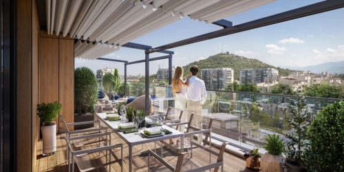
Center
Owning property in the center—in many European cities, this luxury is nearly impossible due to exorbitantly high property prices and expensive living. Here, it’s still possible to purchase an apartment in the center. Owning such a residence is truly valuable and offers undeniable advantages. Whether you live in the apartment, rent it out, or sell it one day, properties in the center hold their value and always will. Global experience shows that even during crises and nationwide price drops, the most elite locations continue to appreciate, though not at the same pace. Living in the central area, you’ll always be close to the most important institutions, services, representations, banks, shops, establishments, and can complete any task quickly. Public transport or a car is almost unnecessary here—everything is within arm’s reach, and walking is nearly always the easiest, fastest, and most convenient way to move. All major city transport arteries start or pass through the center. If you love culture, this is the place for you—cinemas, concerts, theaters, events, exhibitions—nearly all cultural life is concentrated and happens in the center. There are always open establishments, shops, and pharmacies here. Sofia’s center is rich in green spaces—iconic gardens and parks lie at the city’s heart. If you enjoy nightlife or tend to stay out late, you won’t need to rely on taxis constantly. Life in the center seems never to stop—except during long holidays when days blend together, or in August, when everything quiets down, and people and cars become significantly fewer.
Real estate agents widely believe that in five years, individual properties will appear on the market, and owning an apartment in the center will become a rare opportunity. Of course, parking remains a major issue here. Despite paid blue and green zones, the influx of cars is enormous, creating incredible challenges for property owners parking their vehicles. Additionally, residential buildings in Sofia’s center are old and not always renovated—most are unrefurbished, typically 4–5 stories without elevators.
Yavorov
This is one of Sofia’s most preserved and green districts, located between Tsarigradsko Shose and Geo Milev. Considered the capital’s first residential complex, its buildings are low-rise and entirely of old construction. Final development began in early socialism and was completed in 1961. During the socialist era, the upper residential part was named Lenin. The district is a true gem—as if you’re in Borisova Gradina, across Tsarigradsko Shose. It’s very peaceful, full of playgrounds and greenery. Decades-old trees, few cars, and cozy alleys isolate this residential complex from urban noise. Besides numerous green inter-block spaces and spacious apartments, it houses a key state institution—the Ministry of Foreign Affairs.
Buying real estate in Sofia is a profitable investment in quality of life and financial future. The city offers unique opportunities for those seeking a home in the capital, an apartment in the center, or properties for rental income.